Sediment Informs the Future Shape of Our Shores
sEDIMENT TRANSPORT AND SHORELINE MORPHOLOGY
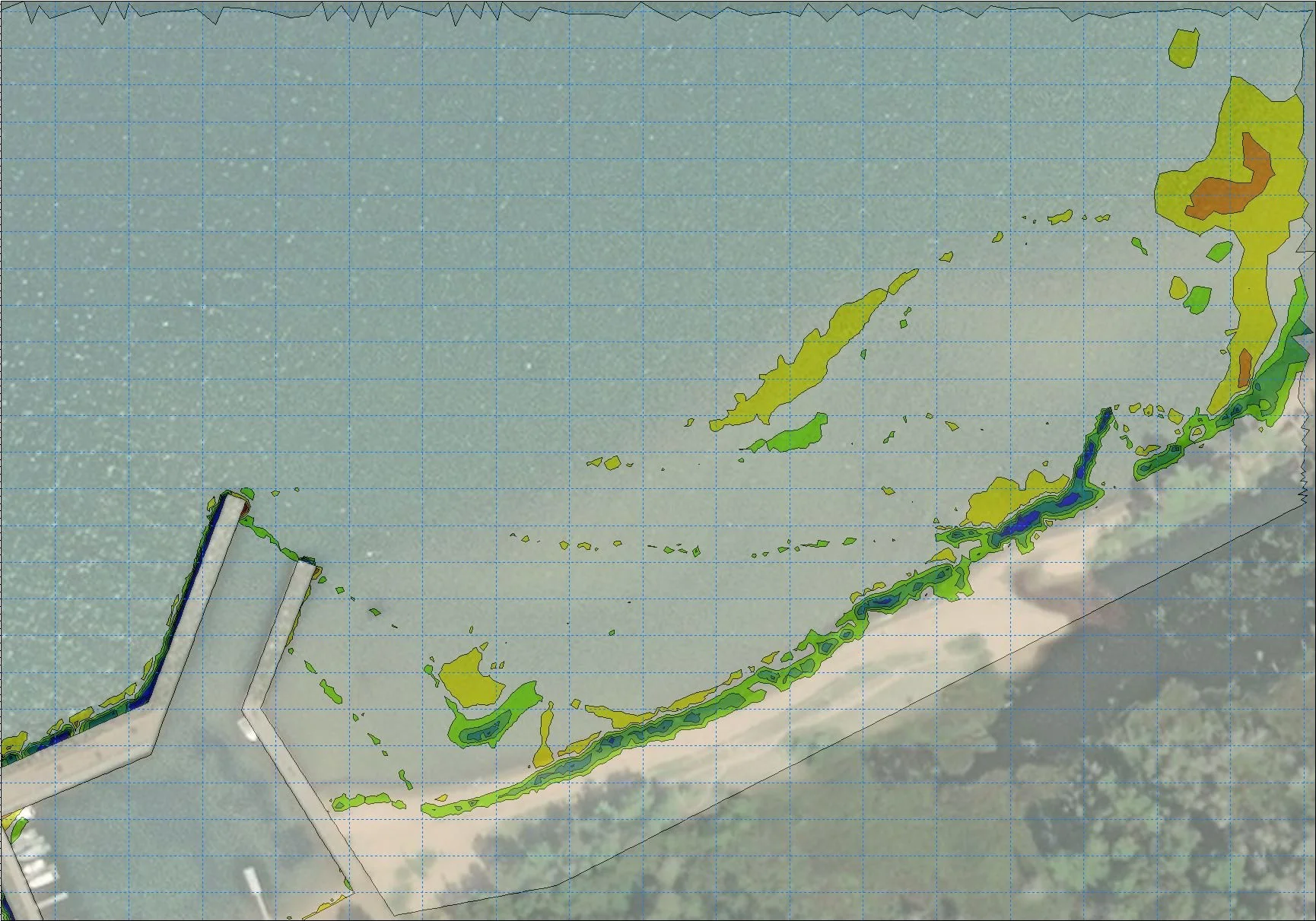
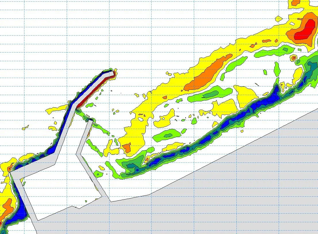
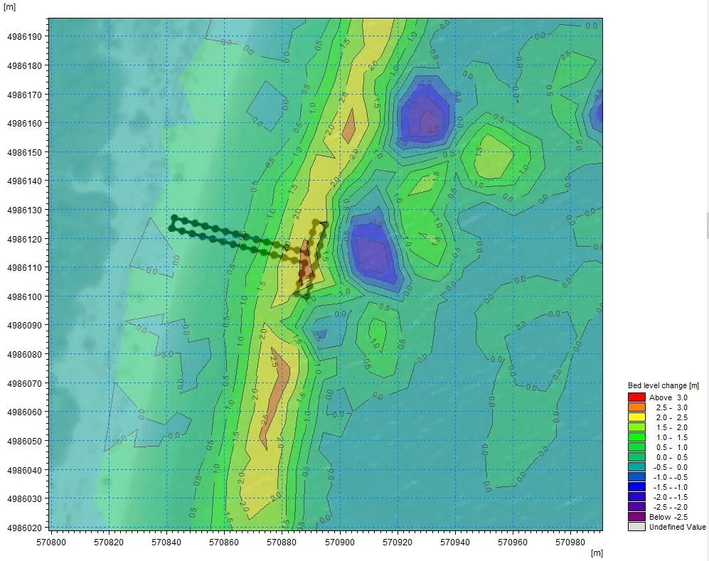
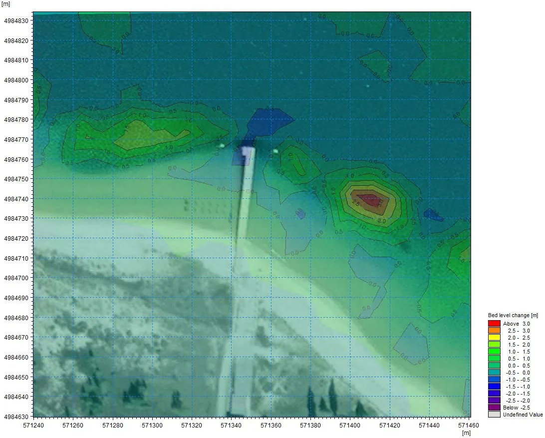
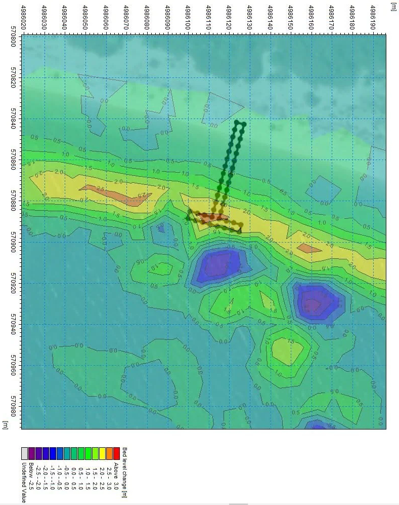
Sediment transport is a critical natural process that moves sand, silt, and gravel through riverine, coastal, & lacustrine environments. Modeling sediment transport is crucial to determine if any impacts will be caused by shoreline development or infrastructure projects. These models can identify the locations and depths of scour in riverine environments and predict future shoreline morphology.
BENEFITS OF SEDIMENT TRANSPORT MODELING
Prediction: Helps predict areas prone to bed erosion or sediment accumulation, supporting better management of shorelines, ports, and harbors.
Infrastructure Protection: Control structures, such as levees or storm walls, provide a physical barrier to floodwaters.
Conservation: Supports the protection and restoration of aquatic and coastal ecosystems by modeling sediment impacts on habitats like coral reefs and wetlands.
The Federal Emergency Management Agency (FEMA) plays a central role in floodplain management by providing flood risk information and developing flood zone maps. One important tool FEMA utilizes to regulate the floodplain is Letters of Map Change (LOMC). These letters officially communicate modifications to the status of a development within a floodplain. A LOMC can be requested by property owners who believe their property has been inaccurately mapped as being within a flood zone.
COMMON APPLICATIONS OF SEDIMENT TRANSPORT MODELING
Predict future dredging needs and schedules
Determine impacts of proposed near-shore and in-water developments & infrastructure
Our in-house expertise in hydrographic surveying, hydraulic modeling, and coastal and marine engineering design enables our team to provide comprehensive services that saves time, reduces cost, and results in a high-quality product for our clients.